
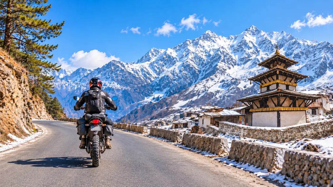

The road from Pokhara to Muktinath is the ride most motorcyclists come to Nepal for. In about 180 km it climbs from the warm lakeside at roughly 820 m to the temple town of Ranipauwa at around 3,700 m. On the way it runs through the Kali Gandaki gorge, between Dhaulagiri and Annapurna I, and comes out into the dry, wind-scoured country of Lower Mustang.
It is not a hard road by Himalayan standards, but it is a long one, and it changes a lot with the seasons. This guide covers the route stage by stage, the paperwork you need, when to go and how to plan the days.
The route at a glance
- Distance: about 175 to 190 km one way (published figures vary)
- Altitude: about 820 m in Pokhara to about 3,700 to 3,800 m at Muktinath
- Riding time: 9 to 12 hours in total, best split over two days
- Permit: ACAP (Annapurna Conservation Area Permit); no restricted-area permit
- Best months: March to May, and mid-October to November
Stage by stage
1. Pokhara to Beni (80 to 90 km)
The first stretch is paved highway, climbing out of the Pokhara valley past Nayapul and dropping to Kusma, where one of Nepal’s longest suspension bridges crosses the Kali Gandaki. It is busy, with buses and trucks overtaking on blind bends, so ride steadily rather than fast. Beni is the last large town before the mountains. Fill the tank here and take out cash.
2. Beni to Tatopani (25 to 30 km)
North of Beni the valley narrows. Much of this section has been widened and blacktopped in recent years as part of the Kaligandaki Corridor highway project, so it is usually an easy ride past Galeshwor and Dana. Tatopani, at about 1,190 m, has hot springs beside the river and is the classic first night.
3. Tatopani to Ghasa (about 20 km)
This is the part of the road that earns its reputation. The gorge closes in, the track is cut into loose rock, and you pass right beside Rupse waterfall, which in wetter months spills onto the road. Expect gravel, rocks, water crossings and, after rain, fresh landslide debris being cleared by diggers. Stand on the pegs, keep the speed low and pull over for buses on the narrow sections.
4. Ghasa to Tukuche (about 25 km)
Above Ghasa the forest turns to pine and juniper and the road eases, with a mix of gravel and new tarmac. Lete and Kalopani sit in the deepest part of the gorge, with Dhaulagiri (8,167 m) on one side and Annapurna I (8,091 m) on the other. It is worth stopping at Kalopani just for the view of the Dhaulagiri icefall.
5. Tukuche to Jomsom (about 15 km)
The landscape changes almost at once: bare brown hills, a wide stony riverbed and the strong wind that blows up the valley from late morning. Tukuche’s old salt-trading houses and Marpha’s whitewashed lanes and apple orchards make this the prettiest place to stop. Jomsom has fuel, mechanics and plenty of lodges.
6. Jomsom to Muktinath (20 to 25 km)
Smooth blacktop runs to Kagbeni, the medieval village at the gateway to Upper Mustang. From there the road climbs almost 900 m on paved switchbacks through Khinga and Jharkot to Ranipauwa, the village below the temple. This is where most riders start to feel the altitude, so take it slowly.
Permits and documents
The whole route north of Nayapul and Beni lies inside the Annapurna Conservation Area, so foreign visitors need an ACAP permit. It costs NPR 3,000 for most nationalities and NPR 1,000 for SAARC nationals. Buy it in advance at the Nepal Tourism Board office in Pokhara or Kathmandu; buying it at a checkpoint costs double. A TIMS card is not needed for this route.
Muktinath is in Lower Mustang, so no restricted-area permit is required. If you want to ride north of Kagbeni into Upper Mustang and Lo Manthang, you need a Restricted Area Permit and a licensed guide.
To ride, carry your home motorcycle licence together with an International Driving Permit that covers motorcycles, plus the bike’s papers. Police and ACAP checkpoints along the road, including around Ghasa and Jomsom, will ask to see them.
When to go, and the monsoon
March to May and mid-October to November give the driest roads and clearest views. Spring is warmer and brings the apple blossom; autumn has the sharpest mountain views.
From June to early October the monsoon brings landslides below Jomsom. In late September 2026 heavy rain blocked the road in dozens of places and floods washed out a section in Myagdi; it took about two weeks to reopen. Closures like this happen most monsoons. If you ride in the wet season, build in spare days and ask jeep drivers at Pokhara’s Baglung bus park about the road before you set off.
December to February is cold, and snow can close the road to Muktinath for a few days at a time. Many lodges in the higher villages close for the winter.
Altitude
Going from 820 m to over 3,700 m in two days is a big jump, and every season some visitors who drive straight up from the plains end up with altitude sickness. Spend at least one night between 2,600 and 2,900 m, in Marpha, Jomsom or Kagbeni, before going up to Muktinath. Drink plenty of water, avoid alcohol on the way up, and turn back down if a headache or nausea gets worse.
A sensible plan
Riding Pokhara to Muktinath in one day is possible but not wise: it is too much altitude too fast, and the gorge is no place to be tired. A relaxed return trip takes four to six days:
- Day 1: Pokhara to Tatopani (about 110 km)
- Day 2: Tatopani to Marpha (about 70 km)
- Day 3: Marpha to Muktinath via Jomsom and Kagbeni (about 40 km)
- Day 4: Muktinath back down to Tatopani (about 95 km)
- Day 5: Tatopani to Pokhara (about 110 km)
A sixth day gives you room for bad weather or a side trip to Lubra or Dhumba Lake near Jomsom.
Practical tips
- Bike: a dual-sport such as a Royal Enfield Himalayan or Honda CRF250L handles the gorge far better than a road bike or scooter.
- Fuel: fill up in Pokhara, Beni and Jomsom. There is little or nothing in between apart from bottled petrol in some village shops.
- Cash: there are ATMs in Beni and Jomsom, but they are not always working, so carry enough for lodges and permits.
- Timing: ride early and aim to stop by early afternoon, before the valley wind picks up. Never ride the gorge after dark or in heavy rain.
- Layers: it can be 30°C in Beni and close to freezing at Muktinath on the same trip, so pack warm gloves and a proper jacket.
- Signal: phone coverage is good in towns but patchy in the gorge. Download offline maps before leaving Pokhara.
For distances section by section, road conditions and other ways to make the trip, see this Pokhara to Muktinath road guide.
Ridden at a steady pace, with a night in Marpha and an early start for the last climb, this is one of the great rides in Asia, from rice terraces to high desert in a few days.
